The Start
We left San Diego on Tuesday morning for the drive to the Grand Canyon.
We drove via I-8 to Phoenix, north to Flagstaff, west to Williams and
finally north to the Grand Canyon. We arrived about 8PM. This was my
first trip to the Grand Canyon, Sal, being the more traveled of this
duo had been there before. The first two nights we stayed at the
Yavapai Motel. Sally brought all our breakfast and lunch food. Dinner
was in a cafeteria.
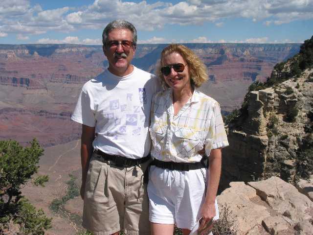
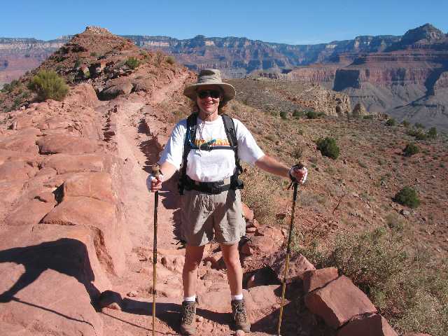
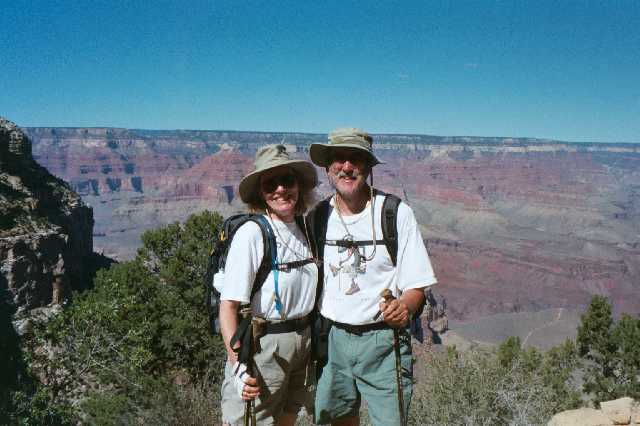
On our first day, we were tourists on the South Rim. Here is the
obligatory picture of us standing at the top. As you probably
heard many times, pictures don't do justice to the beauty of the
Canyon. Also on that first day, we drove over to look the South
Kaibab trail. That was the
trail we were going to hike down the next day. You can't actually drive
to the trailhead - it is open to buses only. But we got to a point
where we could see it.
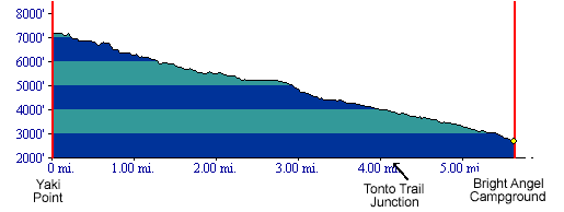
Early Morning Start
On Thursday morning, we found the bus stop for Yaki Point and
got the 7 AM bus. There were about a dozen of us. Here is profile of
the
South Kaibab trail.
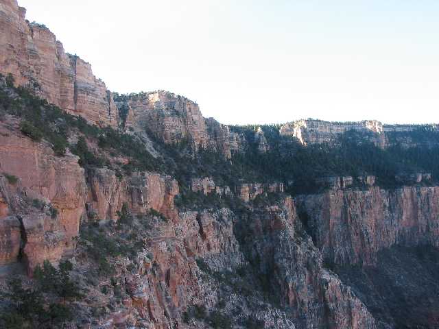
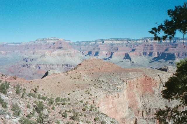
When the bus dropped us off, we were the last ones to start hiking
down. We started about 7:30. I figured we were going to be going fairly
slow so might as well let the others get ahead of us. Here is a picture
looking back up to the top of the South Rim.
Down-Down-Down
The trail headed down along the edge of the Canyon. The trail was in good condition and wide (about 6 feet). It had, for the most part, a rock edging as you can see in this picture. There were very few places where the trail was on the edge of a cliff. Mostly it was just near the edge.
And Down-Down-Down
This picture was taken by Sally. It is the best one we have to show
what the scenery looked like as we walked down. The trail had a lot of
'steps' on it. These were just rocks that gave the feel of steps.
Having our hiking poles were a real help here. In a lot of ways, going
down hill is much harder on the legs and knees as each step down
requires you to use
your legs as brakes.
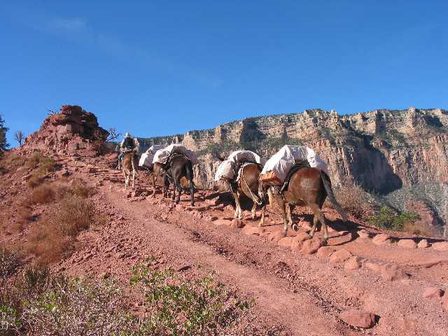
Mule Team Headed Up
We learned later that the mules use the South Kaibab trail to go up
from the bottom. As we hiked down, we encounted several mule teams.
This one was carrying suitcases and others carried people. One of the
options here is travel on mules along with a stay at Phantom Ranch.
Sally the Hiker
Sally led the way downhill. You can't really tell from this picture
but we bought new backpacks. They were day packs that had a built
in water bag. And you can see our hiking poles.
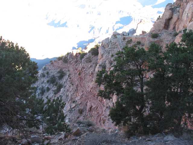
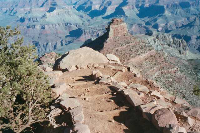
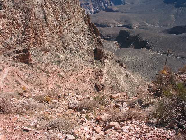
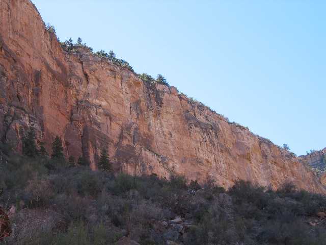
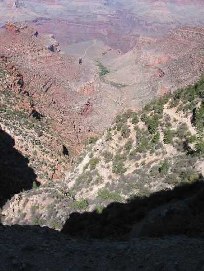
Trail on the Edge
In this picture, you can see the South Kaibab Trail as it goes on
along the ridge. That is why this trail has the best views. You are
pretty
much out in the open the whole way. On a hot summer day, that could be
a real problem. We were lucky in that respect. When we left the South
Rim, the temperature was about 60 degrees. As we headed down, it got
hotter.
Zig-Zag
As we walked along the ridge, it ended and we had start really
heading down. Off the end of the ridge, the trail turned into a zig-zag
switchback as we headed down to the Tonto Plateau.
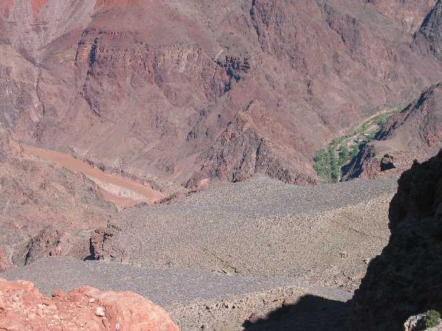
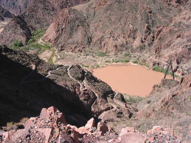
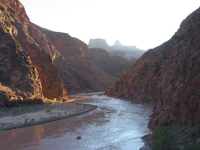
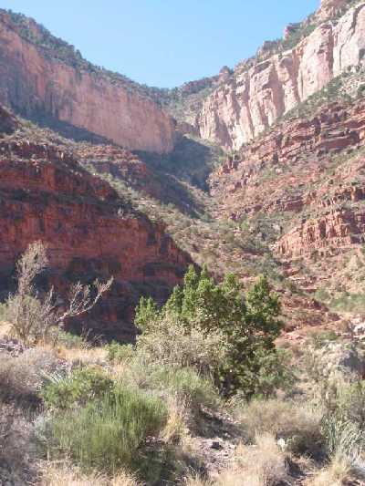
First view of Colorado River and Phantom Ranch
A little further down, we got our first view of the Colorado River.
It was brown. As someone told us later, that is what made the Grand
Canyon grand.. We learned later that the River is usually blue because
the daming
of River has reduced its peak flows to 1/10 of what they used to be.
That
means that mankind has effectively stopped the force that created the
Canyon.
Phantom Ranch is on the right, a little way up Bright Angel Creek from
the River.
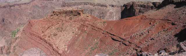
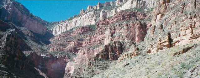
Another Trail on Another Ridge
The trail continued out another ridge as it prepared for the
final descent to the River.
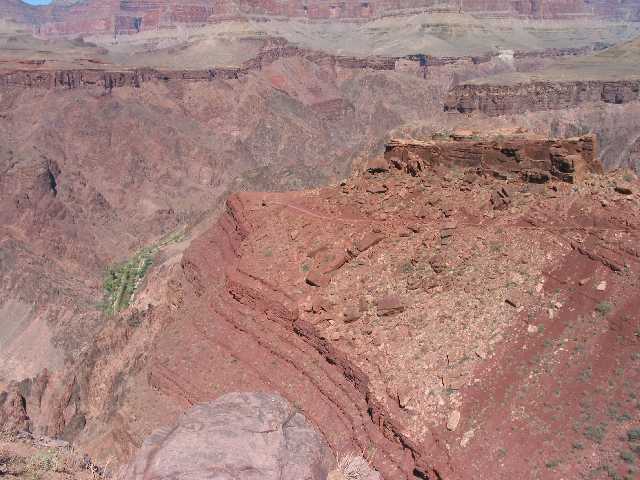
Panoramic View
Here a panoramic view of that last ridge. You can see the trail
going
from right to left around that butte.
Bridge
The trail continued down and we got our first view of one of two
foot
bridges over the Colorado River.
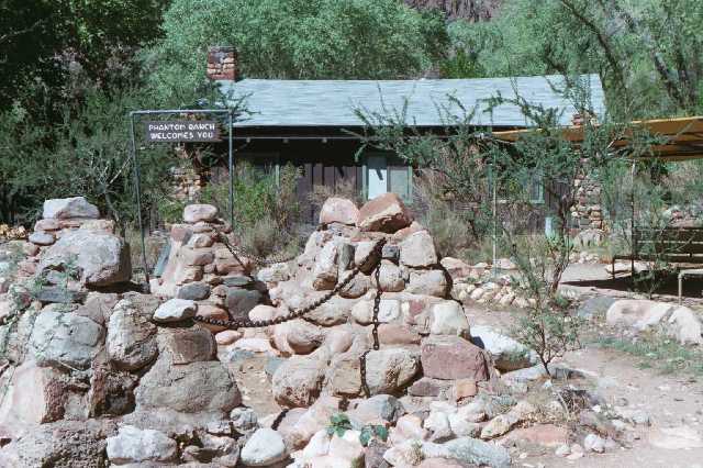
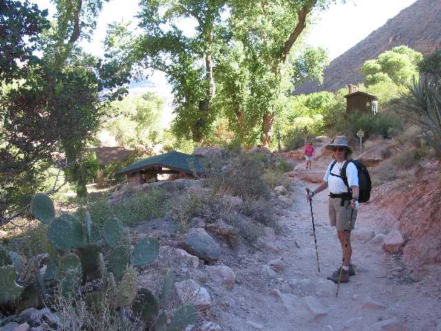
We Made It
After hiking about another 1/2 mile from the Colorado River, we
reached Phantom Ranch at about 1:30 PM. The original buildings here
dated from the 1920's. Now the place is fairly modern. Running water,
electricity, telephone (one) and hot showers. We also signed up for all
the meals while we were there. They served breakfast (at 5 AM and
6:30AM), a bag lunch,
and dinner (Steak at 5 PM and Beef Stew at 6:30 PM). We had the stew
both
nights we were there. All in all the food was very good and there was
plenty
of it. After checking in to our room, we headed out to the Bright
Angel Creek by our cabin and waded in the cold water. (Ooo, that
felt good!)
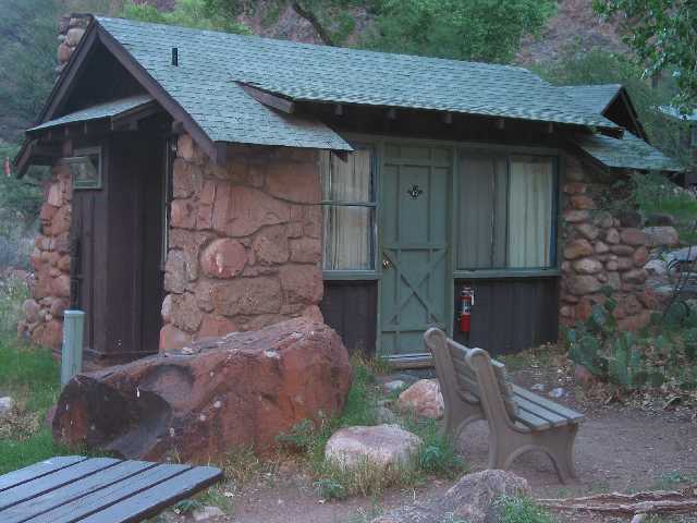
Our Cabin
At Phantom Ranch, we rented a cabin. Actually we rented the cabin 2
years ago - that is how long you have to setup your trip in advance.
The cabin was nice. Had real beds, a sink and a toilet. The sink only
had
cold water. There is also a campground here for the more adventuresome
(and
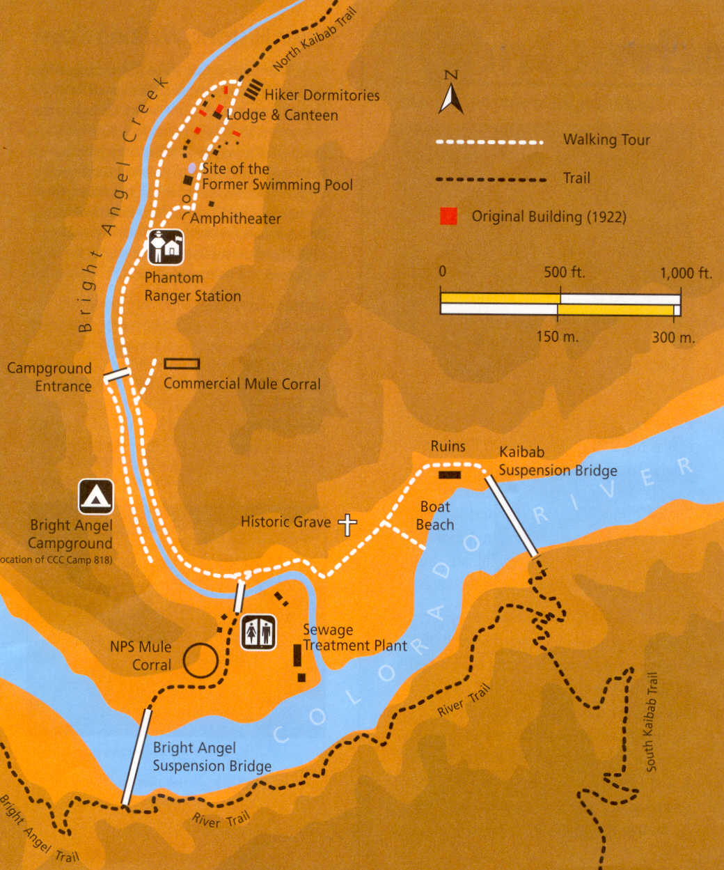
physically fit). Here is a link to a map of
Phantom
Ranch (151Kb).
Friday Day hike
On Friday, I headed out to walk a little way up the North Kaibab
Trail. Sal spent the day relaxing. That trail heads north from Phantom
Ranch
and, about 16 miles later, ends at the North Rim of the Canyon. The
trail
at the bottom is very different from the trails from the South Rim.
This
trail is along Bright Angel Creek for the most part and is in a deep
canyon
of its own. I hiked up for a couple of hours and maybe got 3 or 4
miles.
The trail here is very easy but I don't know what it is like as you get
further up (I've been told it gets harder).
Ranger Talks
Both days that we were at Phantom Ranch, Ranger Pam gave nature talks. The best was one she gave on the geology of the Grand Canyon. She described how the land was formed and then eroded away. Here is a cross section of the layers which underlay the Bright Angel Trail (217 kB file).
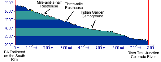
Heading Back Up
On Saturday, we got up at 4:30 AM to get to the 5 AM Breakfast.
After
that, we packed up and left Phantom Ranch about 6 AM. Here
is
a profile of the Bright Angel Trail.
This is the Colorado River at dawn.
Start of the Bright Angel Trail
From Phantom Ranch we hiked along the River for about 1.5 miles.
Then
the Bright Angel Trail headed up out of the Canyon to the south. This
part of the Trail goes up a canyon drained by Pipe Creek.
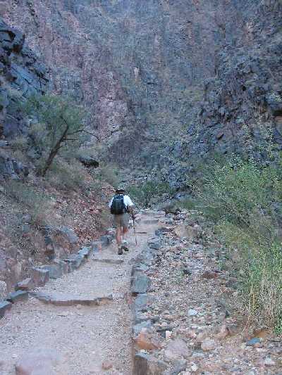
Up-Up-Up
Here is a picture of part of the trail we just hiked up. We are heading up to Tonto Plateau.
Indian Garden
Once on the Tonto Plateau, we reached Indian Garden. We had covered half the distance and 1/3 of the elevation gain. We stopped here about 9AM for 'Lunch'. There were alot of people here. This is a campground where many backpackers spend the night on the way back up.
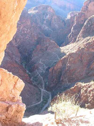
Trail Goes There (Where is it?)
Heading up out of Indian Garden, the trail starts it final climb to
the South Rim. This picture was taken when we were still about 4.5
miles
distance and 3500 feet elevation from the top.
And here (somewhere up there)
This is a panoramic view. I couldn't see the trail at all but I knew
it was there.
Almost There
They say never look up but I couldn't resist.
Looking Back Down
The green area is Indian Garden. This picture was taken from around the 3-mile Resthouse.
We Made It!
We got someone to take our picture after we made it back to the top of the South Rim. Both Sally and I felt great. It sounds kind of funny, but it was not that hard of a hike. Look, Sal is still smiling!
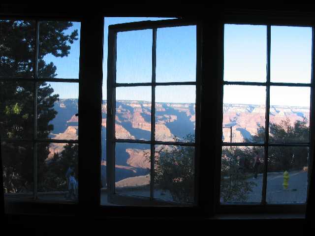
Recovering at the Top
Sally got us a room at the Bright Angel Lodge - right at the TOP of the Bright Angel Trail. We basically got off the trail, walked into the lodge, checked in and went to our room. The room overlooked the Canyon and we were about 100 feet from where the Bright Angel Trail ends. Here is the view from the room. Really the best part is that we could watch other hikers as they got to the top. You should have seen the smiles on their faces.
The Outside of the Room
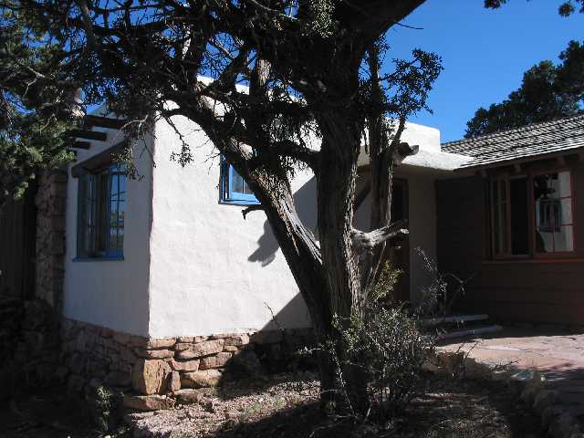
We stayed at the Lodge on Sat and Sunday nights.
The end of our adventure at the Canyon on Sunday was to take the shuttle bus around to see other views of the Canyon. About 1/2 of the area on the South Rim can now be reached by shuttle bus only.
On Monday, we drove back to San Diego via I-40 to Needles (the route
of the old Route 66), south to El Centro, and on to I-8.
After the hike, Sally told me that her strongest thought as we walked
up from the Canyon floor was that the hike was going to end too soon. I
agreed with her as I thought back - we didn't want it to end.
Mark and Sally
markd@san.rr.com
samcpa@san.rr.com
Here are some web links
http://www.grandcanyonhiker.com/
http://www2.nature.nps.gov/air/webcams/parks/grcacam/grcacam.htm
http://www.kaibab.org/geology/gc_geol.htm
Park City 2001
Pittsburgh 1999
Sally's Organ
Idyllwild 1999
Carrizo Gorge 2002
Jerome AZ 2002
The DiVecchio
geneology home page
The Frazzini
geneology home page
The Peden
geneology home page